
GeoBoot used directly for each nautical job
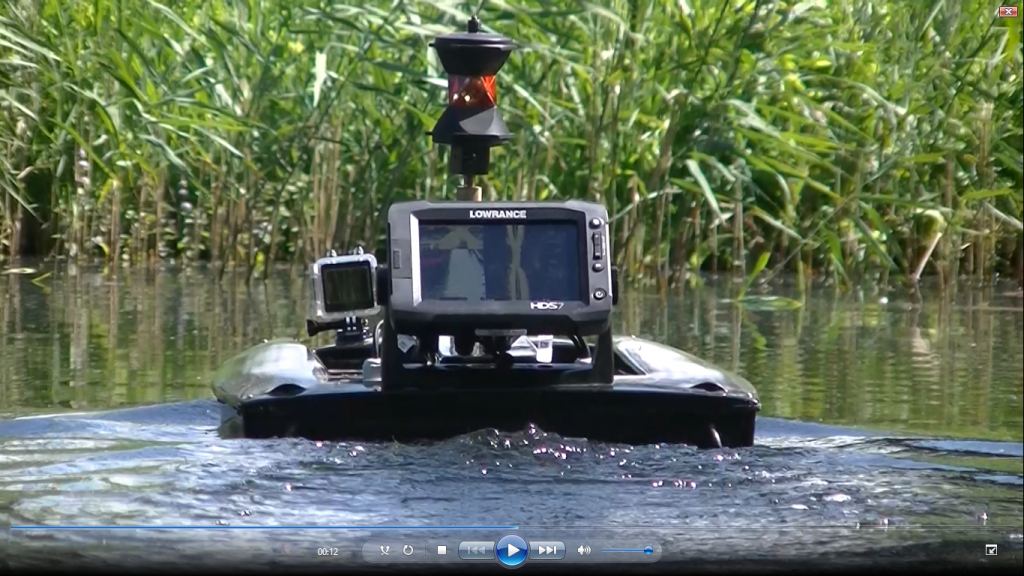
GeoBoot is a craft developed in-house which is suitable for measuring water depths of 0.2 to 50 meters deep. GeoBoot is therefore ideally suited for measuring of ditches, canals and wetlands.
GeoBoot is specifically designed to 3dsonar, structuring and inspection data readily available in the field. GeoBoot can be coupled to each GPS system. Data is directly outside visible and usable in any CAD-GIS system for additional volume analyzes or automatic drawing profiles. The convenient design allows the use of slipway unnecessary.
GeoBoot is equipped with GPS, Single Beam sonar, Side Scan, Scan Structure, video or photo camera and is easy remote control by a pilot. GeoBoot can make long continuous shots.
Therefore to do with the strict rules and regulations for commercial use of drones applicable in the Netherlands.