
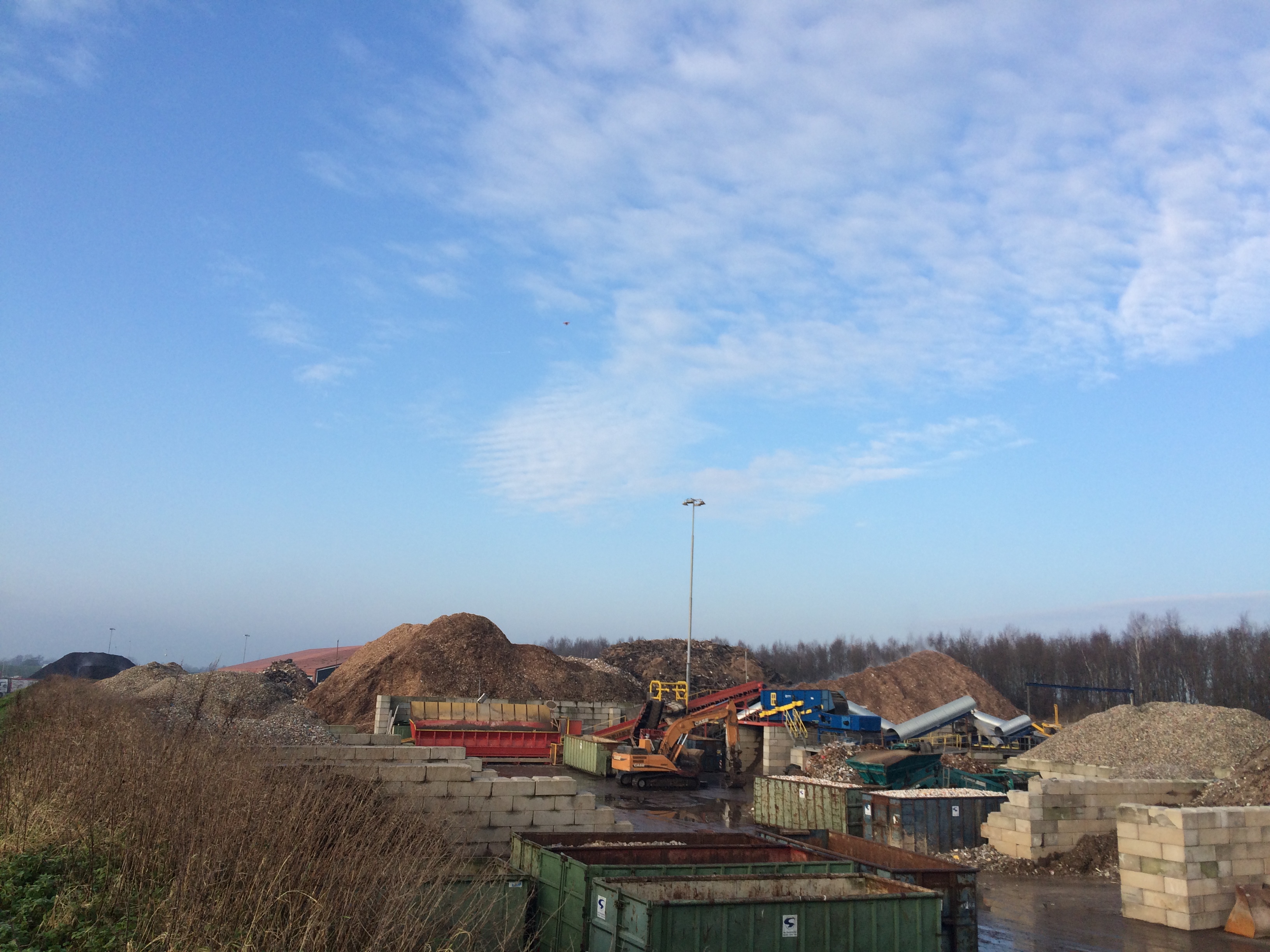
Van Gansewinkel CE depot Drachten 3DGeoMapping has made a 3 model of the circulair economy depots of Van Gansewinkel at Drachten by using a drone for the collection of the data.
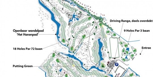
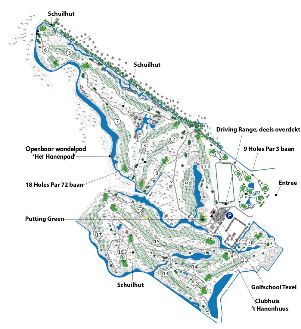
Golfcourse Texelse golfclub
Chris@Geo2016-12-27T18:26:18+01:003D model golfcours Texelse golfclub In assignment from Jos Smit Groenadvies 3DGeoMapping has taken pictures from the golfcourse of the Texelse golfclub using a drone. The pictures will be used to develop a maintenance plan plan for the new 9 holes at the Texelse golfclub.
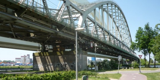
Demka Railway bridge at Utrecht
Chris@Geo2016-12-27T18:27:01+01:00Inspection Demka Railway bridge at Utrecht An assignment from Inspectation bv, a part of the VolkerWessels holding, to inspect the construction of the Demka Railway bridge (build in 1966) in Utrecht. The Demkabridge crosses the Amsterdam-Rijnkanaal. 3DGeoMapping was using drones for the collection of the data. [...]
Documenting locations N18 with drones
Chris@Geo2016-12-27T17:49:29+01:00documenting locations N18 with GeoDrone The contractors consortium Noaber N18 has given an assignment to 3DGeoMapping to measure 14 locations in the new route of the N18 between Varsseveld and Enschede and deliver a 3D model of the locations. In addition 3DGeoMapping has got the assignment to frequently record the progress of the [...]
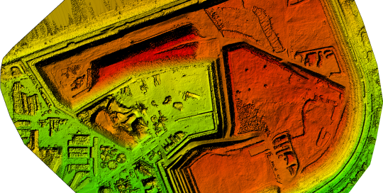
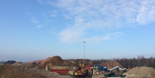
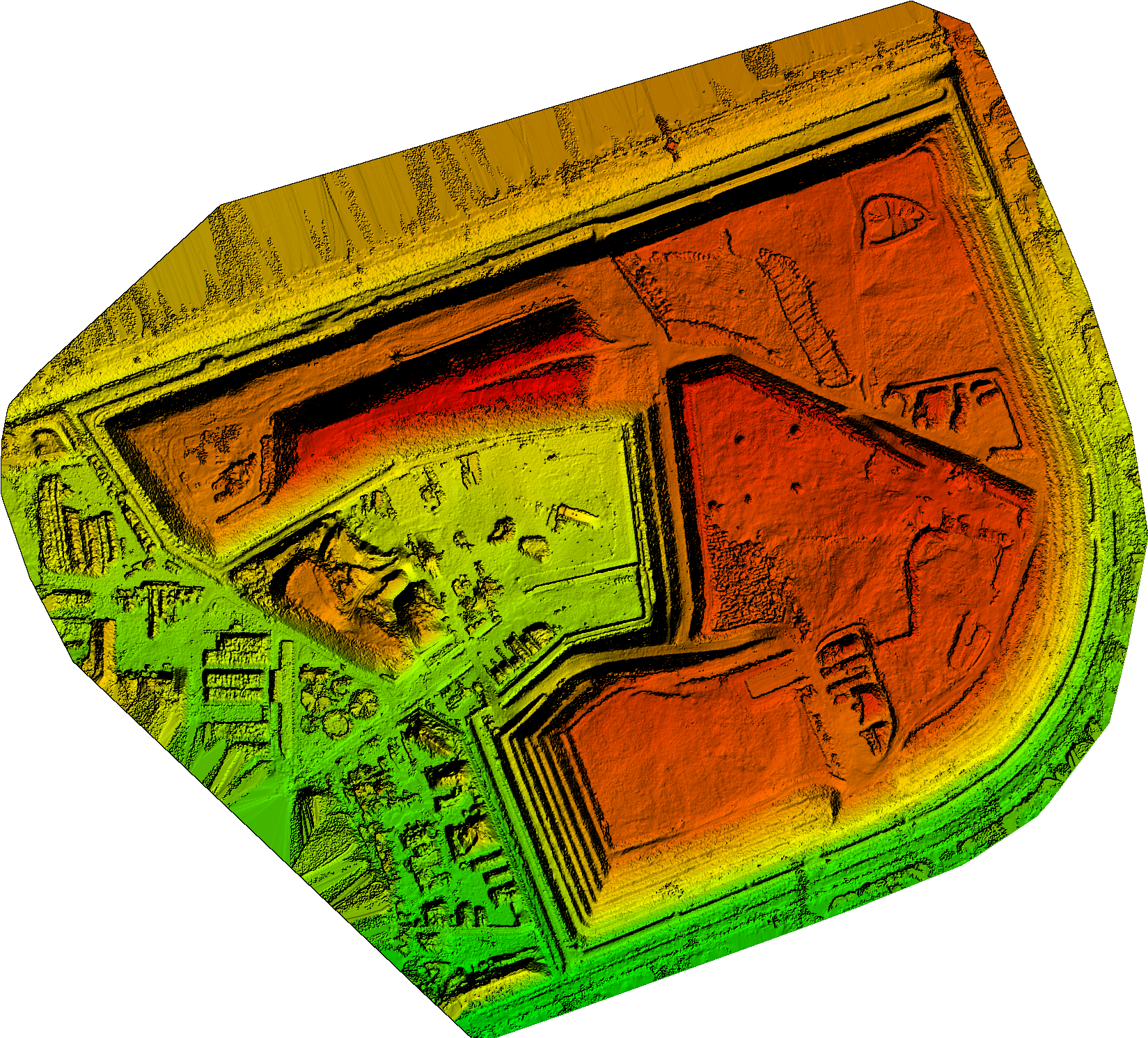
Circulair economy location Attero bv at Wilp
Chris@Geo2016-12-27T18:29:46+01:00Circulair economy location Attero at Wilp Commissioned by Attero bv, 3DGeoMapping has taken images from the stock remaining raw materials with a drone and then converted the data into a 3D model. This model is the starting point for the next yearly quarter recording and measurement. Attero needs better and consistent calculations of the [...]

