
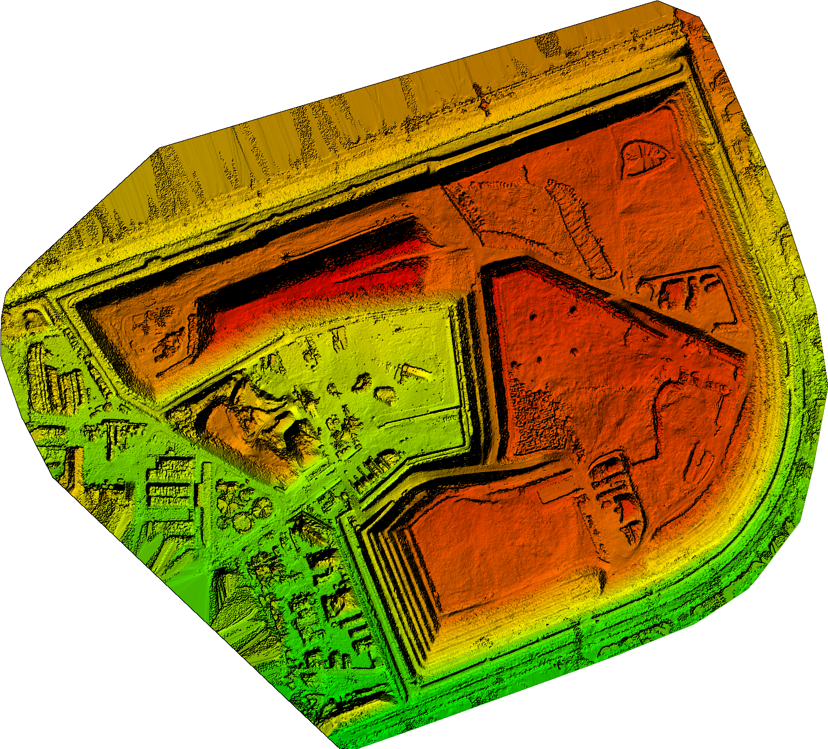
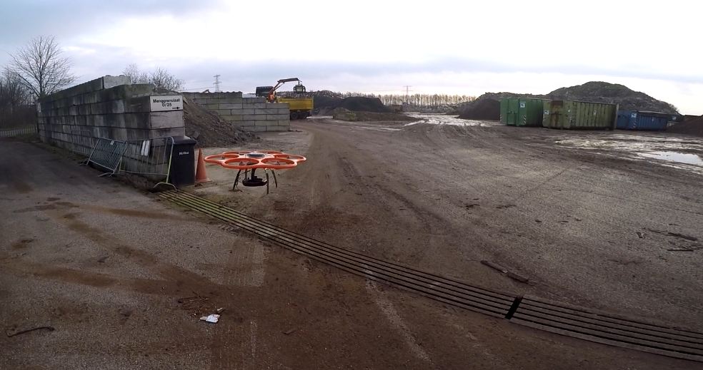
Van Gansewinkel CE depot Drachten 3DGeoMapping has made a 3 model of the circulair economy depots of Van Gansewinkel at Drachten by using a drone for the collection of the data.
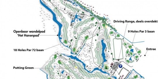
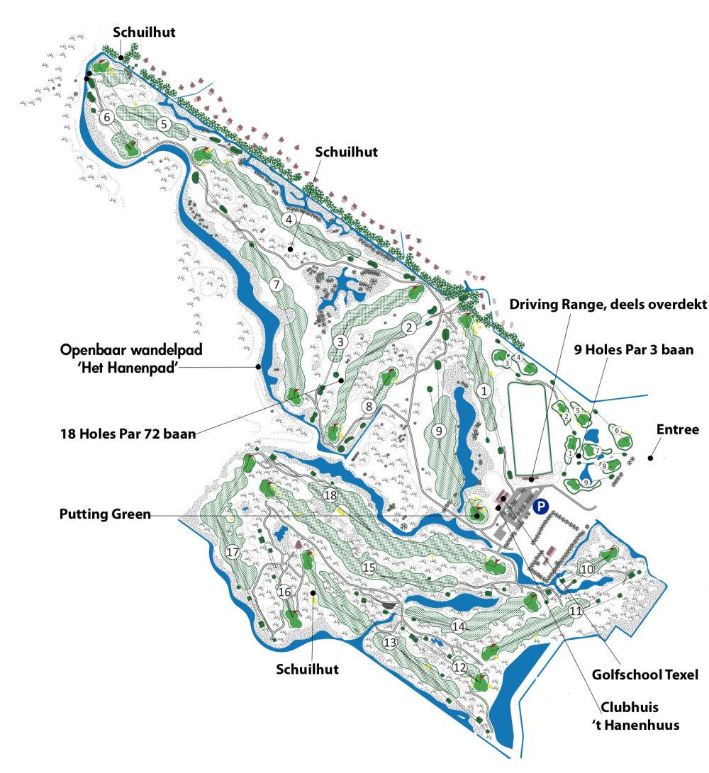
Golfcourse Texelse golfclub
Chris@Geo2016-12-27T18:26:18+01:003D model golfcours Texelse golfclub In assignment from Jos Smit Groenadvies 3DGeoMapping has taken pictures from the golfcourse of the Texelse golfclub using a drone. The pictures will be used to develop a maintenance plan plan for the new 9 holes at the Texelse golfclub.
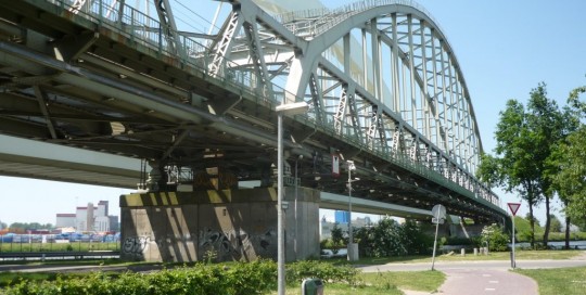
Demka Railway bridge at Utrecht
Chris@Geo2016-12-27T18:27:01+01:00Inspection Demka Railway bridge at Utrecht An assignment from Inspectation bv, a part of the VolkerWessels holding, to inspect the construction of the Demka Railway bridge (build in 1966) in Utrecht. The Demkabridge crosses the Amsterdam-Rijnkanaal. 3DGeoMapping was using drones for the collection of the data. [...]
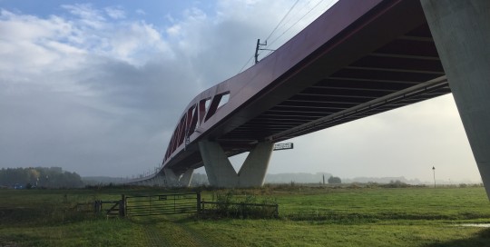
Hanzebridge near Zwolle – Hanzelijn
Chris@Geo2016-12-27T18:26:38+01:00Hanzebridge in Hanze railway track near Zwolle Inspectation bv, a part of the VolkerWessels holding has given an assignment to 3DGeoMapping to inspect the Hanzebrug in the Hanzespoorlijn between Zwolle and Hattum. 3DGeoMapping was using drones for this assignment. The bridge crosses the river IJssel as wel to bypasses who [...]
Circulair economy location Attero bv at Wilp
Chris@Geo2016-12-27T18:29:46+01:00Circulair economy location Attero at Wilp Commissioned by Attero bv, 3DGeoMapping has taken images from the stock remaining raw materials with a drone and then converted the data into a 3D model. This model is the starting point for the next yearly quarter recording and measurement. Attero needs better and consistent calculations of the [...]
Reconstruction Nieuweweg Tienhoven
Chris@Geo2016-12-27T18:28:42+01:00Reconstruction Nieuweweg Tienhoven A contractor has given 3DGeoMapping the assignment to make at the start of the work pictures from the existing situation and made a 3D model of this situation. including the road and the embankment on which the road was built. After realisation of the work 3DGeoMapping will again take pictures to [...]
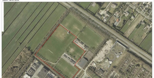
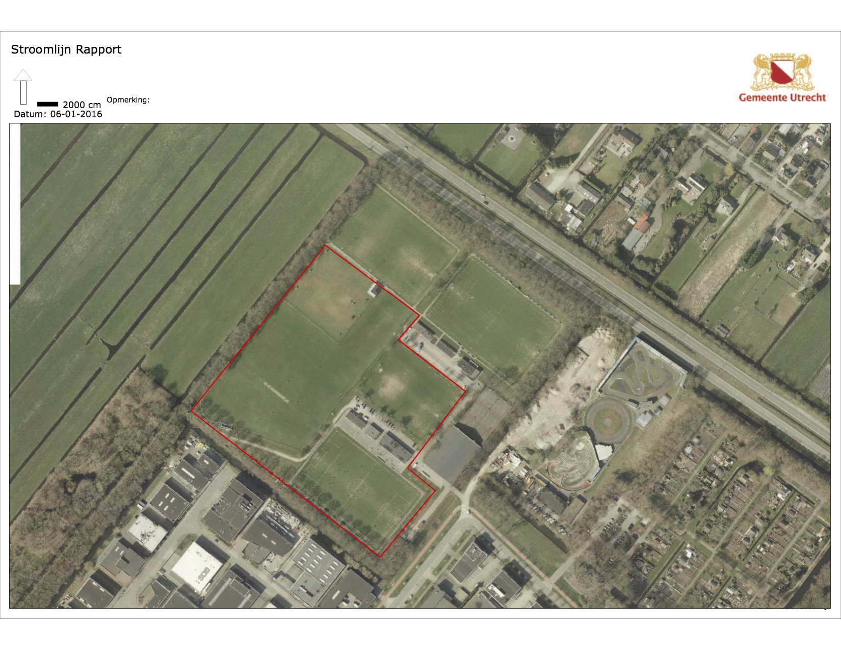
Sun-energyparc at Utrecht
Chris@Geo2016-12-27T18:28:20+01:00Sunenergy parc at Utrecht For the municipality of the city of Utrecht 3DGeoMapping has taken data from the 'is' situation from a former sportsparc witch will be redesignd into a new solar parc using a 3D model as the basis for the final plan development.
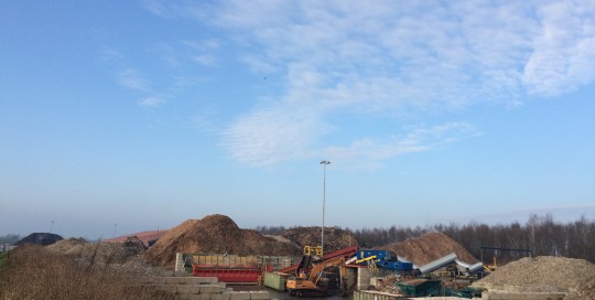
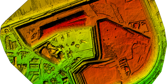
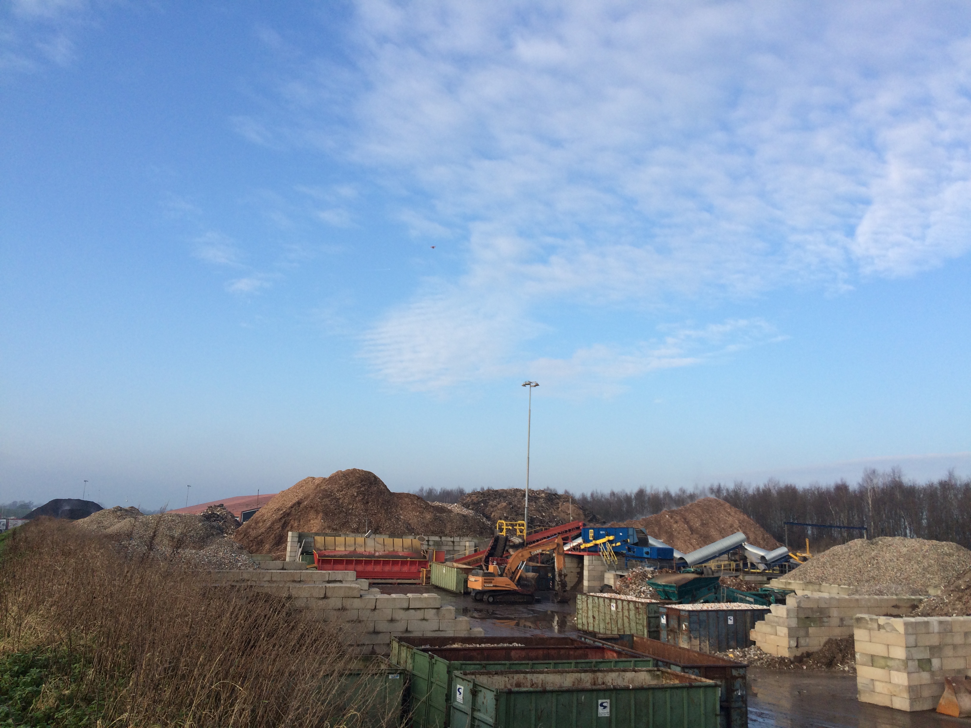
CE plant Van Gansewinkel at Stadskanaal
Chris@Geo2016-12-27T18:29:00+01:00CE plant Van Gansewinkel Stadskanaal For the Circulair Economy depots Gansewinkel is determined using drone for mapping the various depots. Using the 3D model various depots and storage areas can be calculated separately. With a frequency measurement scheme commodity storms can be identified and used to support monthly and quarterly [...]

